
Note the gap in vegetation over the retaining wall in the image above; if the angle of repose for the soil exceeds a certain limit (e.g. 45 degrees), then the risk of a landslide increases. What we're looking at there might be the result of a minor landslide last week during Typhoon Kong-Rey.

Looking back down a recently salvaged section of the 3; I was here a couple of months ago when the construction work was ongoing. The collapsed soil way to the left of that retaining wall contains a mixture of betel nut, bamboo, banana and other trees. Shortly after this stop I made another brief stop to take in a roost of black kites...

There are only three in this image, but that's only because I couldn't get the other three in the frame at the same time. Kites are easy to identify - forked tail and a concave curve in the wingspan. They're also smaller than the eagles, and although size is difficult to judge at distance, on the odd occasion you spot one of them near the eagles, the difference in size is immediately apparent.
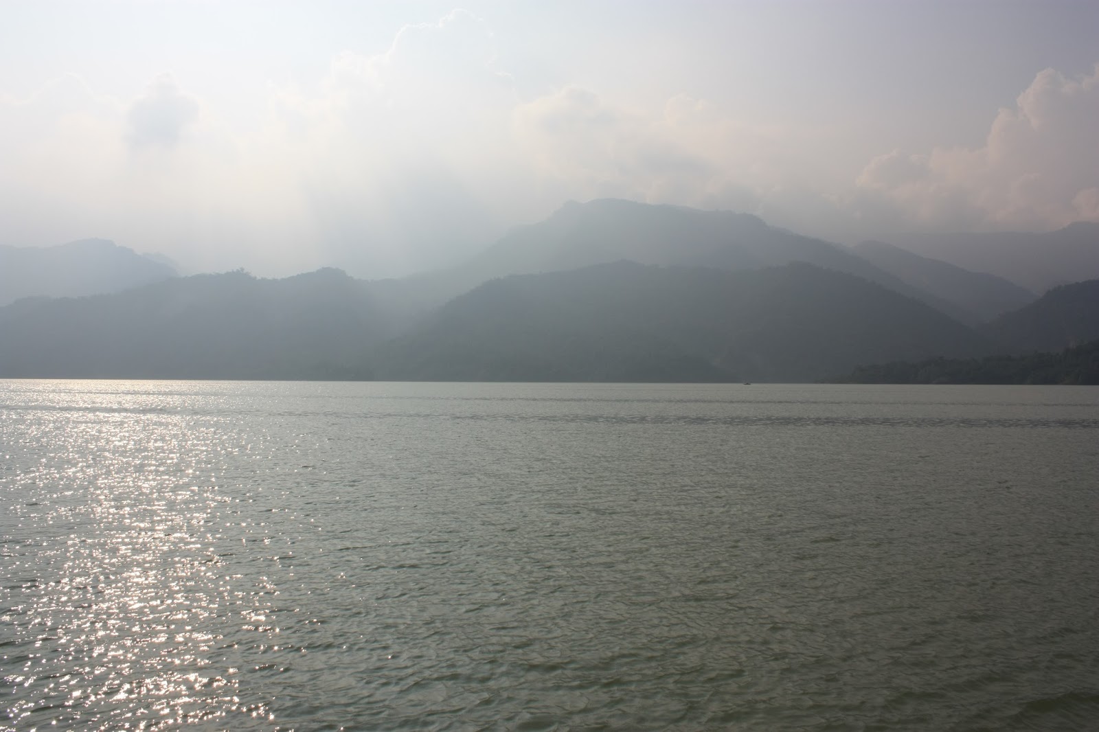
When I eventually got to Dapu village, I was surprised. Of course I had expected to see the reservoir full due to last week's typhoon, but I didn't expect to see this...

I've walked down that road before! That outcrop of grass is actually the top of a hill about ten meters tall, and two years ago I stood at the bottom with my dog looking up at it! There is a broken scooter down there somewhere...


With the additional water brought by Typhoon Kong-Rey, the reservoir must have gained a good two or three hundred million cubic meters in volume. From the eastern shore at Dapu to the western shore should be well over a kilometer in length...
I took some more shots of the reservoir's back end and then left Dapu behind. I stopped briefly at the bridge over the Tseng-wen river to take a shot either side; one looking upstream to the suspension bridge...

... and one looking downstream to this pair of boatmen at work using a debris line to encircle driftwood so that it can be towed to a little harbour further downstream and dispensed with...


I took the right turn uphill at the end of the bridge to make my way up to the old, big weir. It is, I believe, the second largest weir anywhere in Taiwan after a very large one downstream of Techi reservoir high up in the mountains of Taichung County. After the first time I visited this weir (either at the end of last year or the beginning of this year) I neglected to post pictures of the thing for various reasons, so here it is...


The dimensions of the place make it a memorable spot; the local aborigines must also think the fish here are pretty good too. There is a lot of space in this area on the other side of the suspension bridge which would be good for a campsite, since the road isn't too far away and the place is already quite remote. There is another tributary river joining up with the Tseng-wen river here also and a rough path that follows that tributary upstream into Kaohsiung county, though I don't know how far that path goes.
I headed back up to the road, and off down to see the new weir under construction - but first I stopped off by one of the area's smaller attractions...

This waterfall is just off the approach road to the big weir picture above; it's a reasonably secluded spot but I didn't bother to swim because I was getting time conscious - I just took a few shots and then stuck my head in the water to cool off before heading back to the 3 to make my way downstream from the bridge and get myself over the construction site for the new weir.

Completely engulfed by the river - you can just see the two white tips sticking out. Here (scroll down) is what this same view looked like about three months ago. I must be missing something about the design because I don't understand this at all.
No comments:
Post a Comment
Comment moderation is now in place, as of April 2012. Rules:
1) Be aware that your right to say what you want is circumscribed by my right of ownership here.
2) Make your comments relevant to the post to which they are attached.
3) Be careful what you presume: always be prepared to evince your point with logic and/or facts.
4) Do not transgress Blogger's rules regarding content, i.e. do not express hatred for other people on account of their ethnicity, age, gender, sexual orientation or nationality.
5) Remember that only the best are prepared to concede, and only the worst are prepared to smear.