Saturday 5 August 2017

Quick Afternoon Trip To Yuanshuidapi (鹽水大埤)

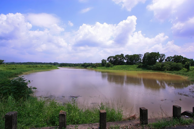
Yuanshuidapi is a small reservoir in Tainan's Xinhua district. Although there are a couple of tiny feeder streams at the back, I suspect it is for the most part a directly rain-fed reservoir like Manzihmanpi or Jianshanpi reservoirs. I was last here about six months ago when the water level was low but yesterday's trip is the first time I've seen Yuanshuidapi full or close to full. 

Yuanshuidapi serves as the source for the Yuanshui river which runs through Tainan and passes by the remains of the old Dutch fort in the west of the city before entering the Taiwan Strait. Built between 1954 and 1955 its' primary function however was to provide supplemental irrigation water to that already provided by the nearby Houtopi reservoir about a kilometer and a half to the south. It is unusual in that the basin of the reservoir is formed from entirely man-made embankments in an approximate figure 8. The brown color of the water indicates high turbidity which may result from the reservoir being so shallow and small; from my observations six months ago when the water level was very low I think the depth of the water here will be no more than four or five meters at the deepest point.

The height of the rushes all along the embankment is an indicator of just how forgotten and neglected this place is. Unlike Houtopi which is a popular fishing spot, there aren't even any locals coming here to go fishing. 

The upstream face of the four spillway tainter gates. There is no dam as such because the embankments encircle the reservoir completely aside from the feeder streams at the back and the spillway gates at the front.

Downstream face of the four tainter gates. Even though they are closed, there is plenty of water seeping out from the eroded undersides of the concrete spillway lip.

Looking up from the end of the spillway channel.

The abrupt end of the channel walls.

The beginning of the Yuanshui river that flows to the Taiwan Strait just to the north of Tainan city proper and the old Dutch fort in Anping. 

On the way home I took a detour to explore a newly constructed extension to provincial highway 39 which runs beneath the HSR line. It runs north from Alian district down in Kaohsiung, through Tainan's Guiren district and the HSR station up into Xinhua and now all the way over into Xinshih district via this bridge over provincial highway 1. Potentially, this could be a superior route for me to get to work in Xinshih's science park on weekday evenings. The river in the distance to the left is the Yuanshui river as it rolls westward between the city's Yongkang district to the left (south) and Xinshih and Annan districts to the right (north).

Looking directly southward over the local TRA railway line between Xinshih and Yongkang to the left and provincial highway 1 to the right with a green corridor in between and the Yuanshui river passing underneath from left to right.

Looking eastward over the railway line and the floodplains of the Yuanshui river toward Yongkang.

No comments:

Post a Comment

Comment moderation is now in place, as of April 2012. Rules:

1) Be aware that your right to say what you want is circumscribed by my right of ownership here.

2) Make your comments relevant to the post to which they are attached.

3) Be careful what you presume: always be prepared to evince your point with logic and/or facts.

4) Do not transgress Blogger's rules regarding content, i.e. do not express hatred for other people on account of their ethnicity, age, gender, sexual orientation or nationality.

5) Remember that only the best are prepared to concede, and only the worst are prepared to smear.