On a subsequent trip to the last bit of work I did in Yunlin county, I drove the bike north out of Yunlin and up through the little townships of Changhua alongside Baguanshan, over the hills and then down into the Taichung city valley where I left it at the HSR station. That was on Sunday May 31st. The following weekend I took a break, and then last Sunday (June 14th) I took the HSR up to Taichung and reacquainted myself with the mad drive up route 125 north skirting around Taichung city to Fenyuang and then eventually up into Miaoli county. This time the objective for the day was to explore the little farmers' roads on the northern side of Liyutan reservoir;
previously I had only seen the dam and spillway and driven around the southern side of the reservoir.
Notes on time: I left Tainan late (sleep) on the 10.15am HSR, arriving in Taichung at 11.00am and then arriving at Liyutan reservoir at just after 12.30pm (the drive out of Taichung and Fengyuan can be difficult due to there being so much more traffic than I am used to down in Tainan). Here I am on the north side of Liyutan's unusual trapezoidal spillway...
 |
| Unlike my previous visit, when the spillway was in action, the water level was now too low to be anywhere near the spillway. |
 |
| The trapezoidal design increases the surface area of the crest and thus allows a much greater volume of water to spill out of the narrow aperture than would otherwise be possible with a single, straight line broad crest weir. |
 |
| The spillway is comprised of five key sections, the middle three of which allow water to spill out on either side. |
 |
| Looking eastward out over the reservoir from a position just the north of the spillway; the east end of the reservoir is occluded by the slope of the hills on the southern shore (right hand side). This geographic "inflection point" in the shape of the reservoir makes it difficult to capture its' entire length and overall shape in pictures. |
 |
| From a fishing spot on the southern shore of the reservoir's east end looking west-north-west toward the inflection point, or "gap" where the water passes through from the east end where the reservoir is fed, to the west end where the dam and spillway sit. |
 |
| From a road above the northern shore looking down onto the east end with the inflection point hidden between the mountain spurs on the right hand side of the image. |
 |
| From the same vantage point as above on the north road, but looking south-east to a peninsula stretching out into the water; the fishing spot from which I had taken the black and white shot above is visible on the far (southern) shore somewhat to the right of where a little road reaches down to the water. |
 |
| High up in the hills on the northern side looking down to the reservoir's east end with the peninsula front and centre. Beyond this point I could not find a single view of the reservoir from any of the northern farmers' roads that I explored (though there was one which I left because there wasn't time for it, but I think it is unlikely to afford any such view). |
 |
| Just before the northern road brought me out at a point well to the west of the dam and spillway, it did afford me one clear view south to the dam (although the spillway is hidden by the clump of trees). |
 |
| The view looking directly eastward up to the spillway and what I gather is an emergency sluiceway station. |
 |
| A closer shot of the buildings and the immense and specially sculpted cliffside behind it. |
 |
| A close up of the buildings. Public access is restricted, but somewhere near the right-hand building there are several high-pressure pipes used to remove water from the reservoir and flush it into the spillway channel when the reservoir is full, which may indicate that despite its' unusual design the spillway still does not afford a sufficient discharge volume relative to the dam's strength characteristics under sheer pressure from a full reservoir. |
 |
| I made my way back eastward the way I came up along the northern farmer's road. Eventually I found an almost forgotten steep little road running downhill and terminating just above a now dried-up little brook which led down to the reservoir. It was there that I found this hitherto unseen spit of land on which somebody was fishing. |
 |
| This could be a promising location for a certain type of photograph I have in mind, but it wasn't possible to take it at the time. |
 |
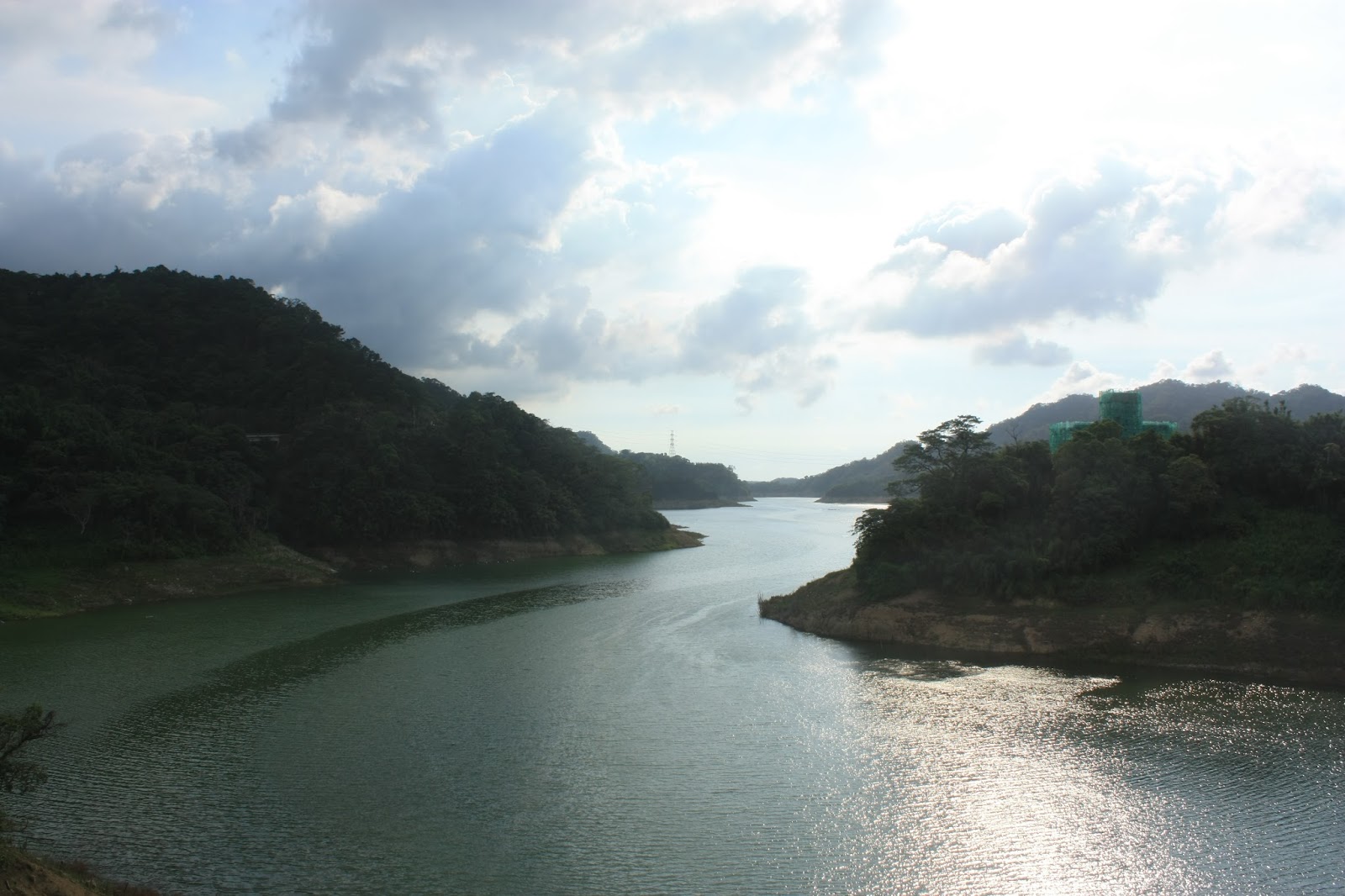
| After leaving the northern farmer's road, I headed back onto highway three to the reservoir's southern shore but paused on the bridge to take some shots looking straight west up the reservoir's longitudinal axis. It being the late afternoon, the sun was directly overhead leaving much of the distant shoreline enshadowed, but in any case it is not possible to gaze directly up to the dam and spillway due to the aforementioned "inflection point" in the reservoir's contours. |
 |
| The same shot taken with a filter attachment to give the clouds greater definition. |
 |
| And another shot moved slightly to the left to include the southern shoreline. I can't decide which of the two I like better. |
 |
| Before I left for Taichung city, I stopped on a cliff on the southern shore overlooking the reservoir's east end to take more pictures. |
 |
| The same shot as above, but moved slightly to the left to squeeze in something of the reservoir's little cul-de-sac just westward of the mountain spurs. |


No comments:
Post a Comment
Comment moderation is now in place, as of April 2012. Rules:
1) Be aware that your right to say what you want is circumscribed by my right of ownership here.
2) Make your comments relevant to the post to which they are attached.
3) Be careful what you presume: always be prepared to evince your point with logic and/or facts.
4) Do not transgress Blogger's rules regarding content, i.e. do not express hatred for other people on account of their ethnicity, age, gender, sexual orientation or nationality.
5) Remember that only the best are prepared to concede, and only the worst are prepared to smear.