
Although I set my first alarm on Sunday morning for 5am, I didn't actually wake up until just after 7am and this was a problem because, bizarrely, Fongshan reservoir closes to the public at 8am. So far as I am aware, this regulation is specific to Fongshan reservoir and does not apply to any other reservoir elsewhere in Taiwan (although I know Feitsui reservoir has round-the-clock restrictions on visitors).

Having consulted google maps as to how to best approach the reservoir from Tainan, I decided to follow Fongnan road straight through my old neighbourhood of Niaosong down from Nanzih and turn onto Fenglin road (highway 25) and just follow that straight down into Xiaogang. I couldn't even find it. Fongshan district is, and in my memory, has always been an absolute navigational nightmare - signs in the wrong places, signs facing west-bound traffic but not east-bound traffic, highway numbers missing etc... In the end I just guessed my way through the mess, and probably lost about a half-hour. Eventually though I found it at the top of the hill round the back from Xiaogang into Daliao district: Gaoping 23rd road.
The gate I initially arrived at was some distance to the north of the reservoir after 23rd road came to a dead-end. That gate was for staff only, and so I had to drive around to the east and south (Gaoping 18th road to Tianchi road) before I eventually found the public entry gate at the north east (back end) of the reservoir.

And here is the sign confirming the bizarre opening times: 5am-8am and 2.30pm-4.30pm. For somebody like me coming all the way down from Tainan, this is a fairly significant inconvenience: to get here at 5am, I'd have to leave Tainan at something like 3am! As it was I arrived there at just after 11am, but intended to scout around anyway.

The main thing I had been intent on finding on this trip was the downstream face of the main dam itself. Eventually, after tracking down several cul-de-sacs, I did find it - at the end of a little village road with a dried-up watercourse running parallel to it, there was a padlocked gate which had been left open. On the other side of the gate there was a footpath running alongside the now dried-up stream. When I first saw the watercourse near the road I had surmised, based on a geographical sense of how far south I had came, that this was the spillway channel from the main dam. And I was right...

To the left (south) of the dam there was a concrete rill channel which also served as a makeshift path to climb up the dam (although I was alone when I arrived, several other locals followed my path up the rill later).

To the right (north) of the dam there was another such rill...

The view northwards from half-way up the dam...

The view northwards from the crest of the dam...

Looking out from the crest of the main dam onto the reservoir; Fongshan reservoir is slightly unusual in that it relies on three earthwork dams rather than one - the dam visible on the other side of the reservoir in the image below is the "back" dam and is the longest of the three...

A 250mm shot of the water intake tower and the buildings behind the "back" dam...

Another view of the "front" dam...

Another distinctive feature of Fongshan reservoir is the unusual design of the spillway; instead of being located on the same north-south axis as the front dam, it is set perpendicular to that on a west-east axis and at some distance (approximately 110 meters) back from the crest of the front dam. Shaped like a coffin, the spillway is fed water on its northern side via an open overflow ogee-crest, with a retaining wall on the southern side.

The entire spillway cavity is on a downward slope from west to east, where the water is strained out through a debris-grill into an underground channel passing out through a large aperture some distance further forward of (and well to the south of) the dam's toe.

The spillway cavity is 50 meters in length, and at the time I visited the water level seemed to be about eight meters or so below the ogee crest. It is somewhat similar in overall shape and layout to the open overflow spillway at Yongheshan reservoir in Miaoli, but differs in that only one edge is exposed to the water and it is (therefore) substantially longer than the spillway cavity at Yongheshan.

I walked some way westward up the gentle slope of the road to a clearing in the trees from where I could see the almost 90 degree inflection in the reservoir's outline; the water runs down from a source to the north and then bends around eastward toward the front dam...

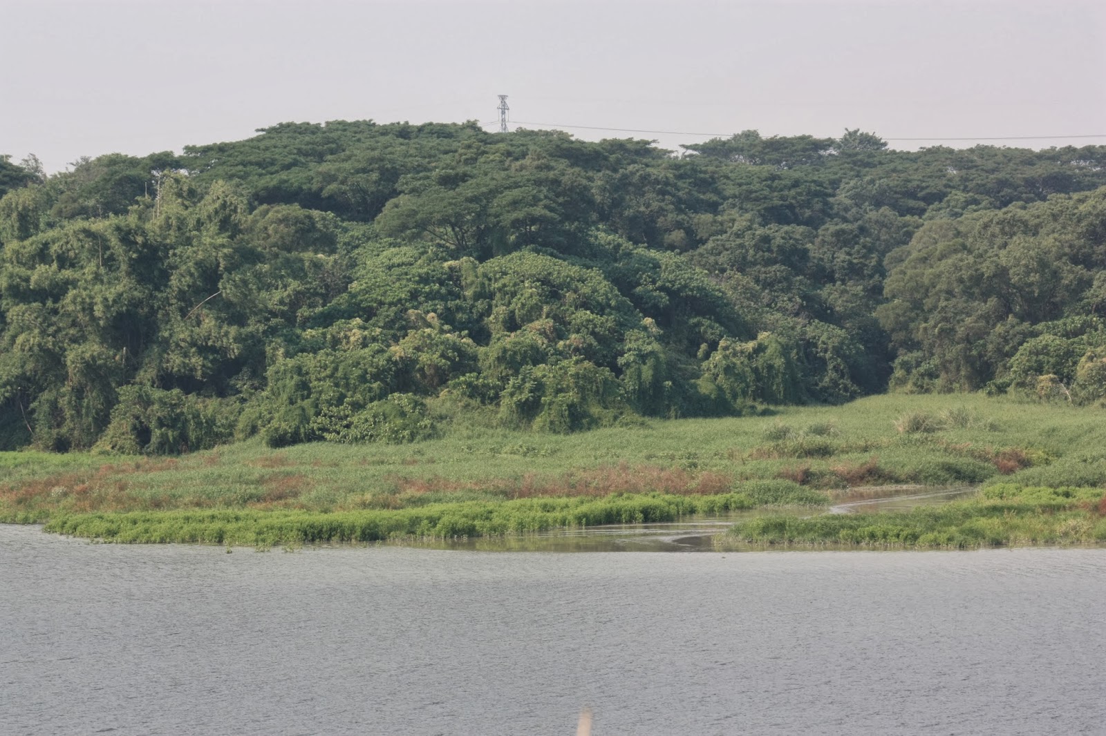
In this shot below, you can see the point at which the back dam transitions into tree-topped hillside...

I didn't follow the road all the way for a couple of reasons; first I was time conscious, second I didn't want to attract attention since I hadn't even planned on getting this far in the first place and third, I wanted to see if I could find another path further to the north that would let me see the beginning of the reservoir. Another shot of the front dam taken on my walk back down the road...

I stopped for a short time to remember what possible access roads I had already seen, and then noticed something off to the north - a pair of Ospreys...

I have always found Ospreys to be difficult to photograph. On this occasion they were some distance away from me in any case so I wasn't going to be able to get a good shot, but even when I've been lucky enough to get fairly close to them they tend to be very shy and don't want to stay still.

Another view of the spillway cavity looking westwards from the crest of the front dam...

I walked along the road rounding the eastern shore of the reservoir from the front dam and headed northwards. Here is a shot of the western shoreline just after the transition from back dam to hillside; the red-and-white scaffolded chimney is for exhaust gases from the water treatment works (I would assume the gas in question is largely methane); the square-shaped, pastel blue building is the standard-issue water bureau office and the light-olive green building next to it must have some function related to the water treatment works. Unfortunately, the water treatment works is off-limits to the public. In the water below the buildings, you can see a small gas eruption...

A closer view of that here...

Further along the northward road on the eastern shore, here is a view to the extreme north of the reservoir; the bridge in the distance allows staff from the water treatment works to exit the reservoir toward Daliao district to the east. Just prior to that bridge and out of shot to the left is Fongshan reservoir's highly unusual and distinctive "fountain", by which I surmise the reservoir is primarily fed. This image also shows the third earth dam on which the reservoir depends (it is also the smallest of the three).

A small tributary stream entering the reservoir to the northwest...
A family somehow found their way onto the northwestern shoreline to go fishing. Fongshan reservoir used to be so polluted from pig-effluent that there were no fish. It has subsequently been cleaned up.

A rare view out through a gap in the canopy of trees toward the east; in the grey, hazy distance you can just make out a bridge crossing the Kaoping river to Pingtung County...

I had been hoping that the northward road would open up to allow a view toward the strange fountain to the west, but I walked its entire length and found no such gap in the treeline. I walked so far that eventually I could see the back gate again, and so I gave up and headed back the way I had came.

A view over the third dam west-south-west toward the back dam...

An abundance of grey herons (I saw several) testified to the presence of fish and thus a relatively high oxygen content for the water...

A fruit tree - but I don't know what kind of fruit that is; they're not mangos (it's not the season) and they're not bread-fruit, so I'm not sure what they are...

Back on the crest of the front dam, a view looking out eastward downstream to the spillway watercourse and the way I had came...

After a quick bite to eat in a nearby 7-11, I drove round to the back gate to the north once more since it was then 2pm. I sat down on a curb to wait, but the guard opened the gate for a car to pass out and so I walked in. However, the road down to the bridge and the fountain was apparently off-limits to the public...

This is a google street-view shot of the "fountain" I had came to photograph...

I tried to explain to the guard that I didn't want to go into the water treatment works, but just wanted to photograph the "fountain". I expected to be told he'd need to call a superior, or that it'd be OK if I came straight back, but I had to roll my eyes when he told me that there was no such fountain. I explained it to him quite clearly to make sure he didn't misunderstand what I was talking about, but the reply came back once again - "沒有理" (don't have). I could see the water falling down from behind the trees in the distance...

I've found in the course of my reservoir research that it's normal for low-level employees of the water bureau to just lie to me (the same thing happened at the Yanchao office). I will have to see if I can talk to someone at the Dashu office to get a permit to photograph the "fountain", and I might need their help in the future anyway to get a similar permit to visit and photograph Feitsui reservoir in Taipei County.
No comments:
Post a Comment
Comment moderation is now in place, as of April 2012. Rules:
1) Be aware that your right to say what you want is circumscribed by my right of ownership here.
2) Make your comments relevant to the post to which they are attached.
3) Be careful what you presume: always be prepared to evince your point with logic and/or facts.
4) Do not transgress Blogger's rules regarding content, i.e. do not express hatred for other people on account of their ethnicity, age, gender, sexual orientation or nationality.
5) Remember that only the best are prepared to concede, and only the worst are prepared to smear.