The district maps provided by the Kaohsiung government are somewhat better, but still lacking the essential features I need. Here is a cropping of the northern bit of Yanchao district - notice the angular sprawl of the reservoir to the left of the image...

Now I have a rough idea of where the channel's entry point (and the adjacent temple) lies on that map anyway, but the problem is that the channel can only be followed so far along the little farmer's road before you simply run out of road. The channel winds its way out of sight. So I had to take a little road (the 29-1) out of the valley and back onto the main road - Xixing road - running from west to east in Tianliao. However, since Xixing road is raised over the valley floor the channel becomes hidden from sight once again. There are several more small farmer's roads leading back down into the valley which I will need to check next time, but the map itself is no help.
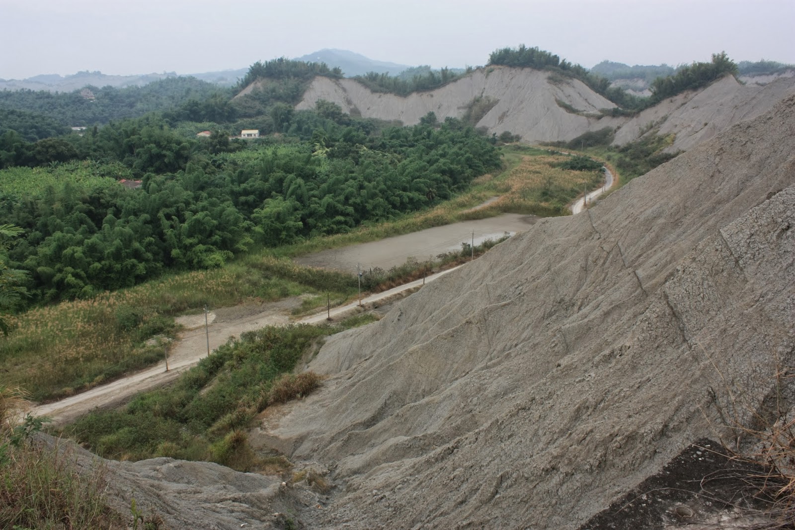
Here is a cropping of the southern section of the adjacent Tianliao district to the immediate north of Yanchao. The sweet-potato shaped mountain to the left is Dagangshan, with the north-eastern bend of the reservoir immediately below it.

This map offers no direct indications of where the channel might lie either. Instead there are a number of winding water courses any one of which could perhaps form at least part of the diversion channel. This requires a slow process of elimination (although two or three can obviously be ruled out from the start, e.g. the Erjhen river). Certainly, the "Tianliao river" which runs under the freeway to the bottom right of the image above is not what I'm looking for because it is too shallow and largely stagnant - as were most of the other streams I came across. Whichever watercourse actually is the diversion channel must be fairly deep (e.g. half a meter) and slow moving, or shallow and fast moving. I did find something matching this description just south of Chongde village, but it may have been too far to the north and west.


The whole of Tianliao district is a natural labyrinth, though I eventually found my way out of it and up into Neimen district (and then back down into Tianliao district, after eliminating a couple of watercourses there).

The so called "Moonscape" of Tianliao consists of waves of mudstone ridges formed millions of years ago, but unlike similar landscapes elsewhere in the world (e.g. the arid "badlands" areas of Spain and the western United States) these ridges are usually topped with vegetation, streaming with watercourses and ponds between them and surrounded by fruit farms...

I eventually gave up trying to relocate the diversion channel in the mud-maze of Tianliao and headed back down to Yanchao to the diversion channel's entry point to see if I could follow up a few other farmer's roads. By this time it was well after 4pm, the sun was beginning to do down and I was getting tired (I had left Tainan at just after 12pm). I crossed over the bridge to the other side of the channel and took some pictures of it from its' eastern bank...

Notice the little weir inside the channel just before the bend; I might try to do the measurements myself next time if I remember to bring a tape measure and a measuring stick.

Another appearance in design of nature's curving "line of grace". I used one of the filters to take this shot, since otherwise the sky would either have been too bright or the trees and bushes would have been too dark. For an overcast and forgettable day weather-wise, I was quite pleased with this shot.
I'm going to study the maps some more and make a list of little roads to check for signs of the channel in Tianliao. I might also think about tracking it the other way; downstream from the Neimen control gate. I think this is going to take weeks.
No comments:
Post a Comment
Comment moderation is now in place, as of April 2012. Rules:
1) Be aware that your right to say what you want is circumscribed by my right of ownership here.
2) Make your comments relevant to the post to which they are attached.
3) Be careful what you presume: always be prepared to evince your point with logic and/or facts.
4) Do not transgress Blogger's rules regarding content, i.e. do not express hatred for other people on account of their ethnicity, age, gender, sexual orientation or nationality.
5) Remember that only the best are prepared to concede, and only the worst are prepared to smear.